Content
A global analysis of the characteristics that drive interaction with the U.S. Geological Survey's "Did You Feel It?" product
The Intensity Gap: A Global Analysis of Who Responds to the Crowdsourced Did You Feel It? System
Eli Knodel
Researcher

Achieving Collective Impact in Earthquake Science Podcast

Marísa Macías
Project Manager
This poster provides an overview of research to understand who access DYFI? globally.
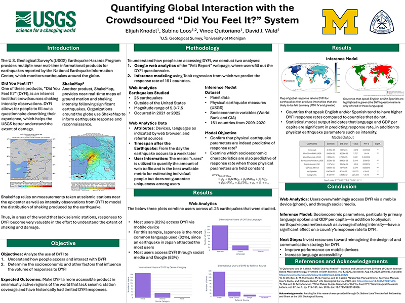
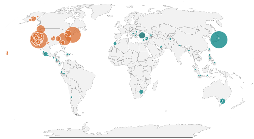
Quantifying Global Interaction with the Crowdsourced ''Did You Feel It?'' System
Eli Knodel
Researcher
This poster, which won 1st place for Theoretical and Social Sciences, provides an overview of user engagement to design more actionable earthquake information products at the USGS.
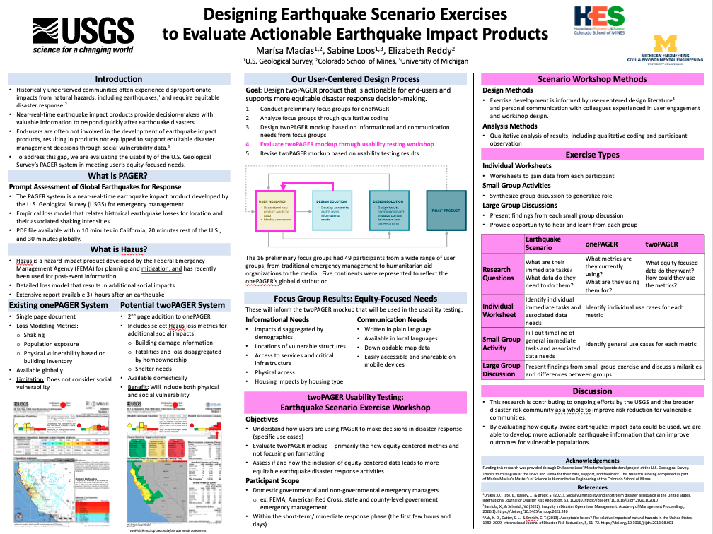
Designing Earthquake Scenario Exercises to Evaluate Actionable Earthquake Impact Products
Marísa Macías
Project Manager
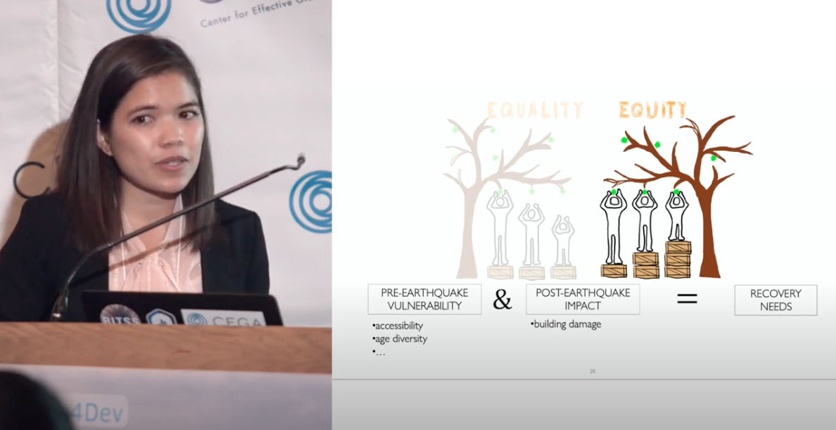
Post-disaster data overwhelmingly focuses on immediate impacts on buildings rather than the long-term needs of populations who live inside those buildings. As shown in this study of the 2015 earthquake in Nepal, data can instead be leveraged to capture the recovery needs of vulnerable populations.
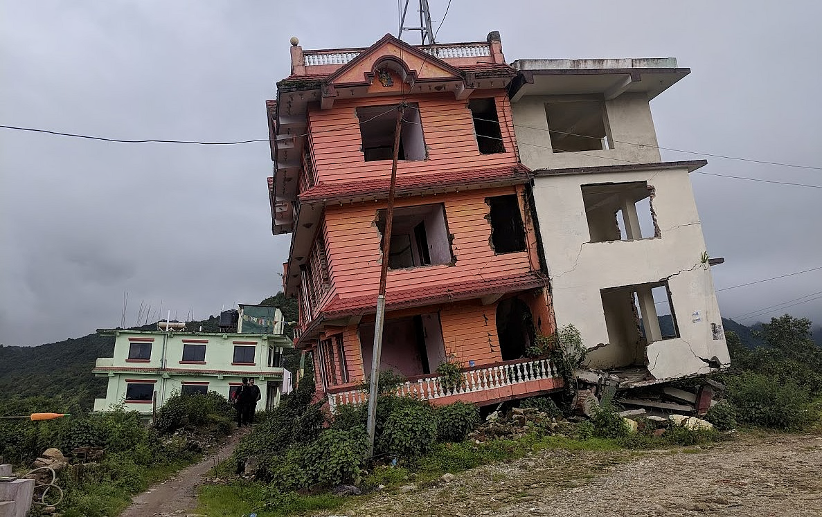
Big data for whom? Data-driven estimates to prioritize the recovery needs of vulnerable populations after a disaster

Sabine Loos
Assistant Professor
Going beyond building damage to support vulnerable populations' recovery needs after a disaster.
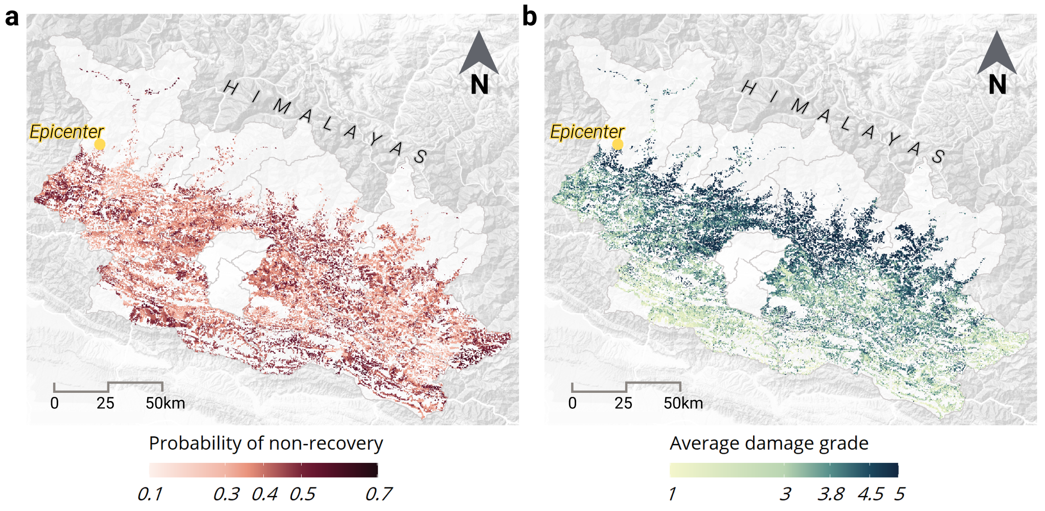
A data-driven approach to rapidly estimate recovery potential to go beyond building damage after disasters
Sabine Loos
Assistant Professor
An overview of integrating social equity into risk modeling.
Understanding Risk 2022 -- Interview with Sabine Loos.
Sabine Loos
Assistant Professor
Evaluating how effective data integration for damage estimation with different data sources across different contexts.
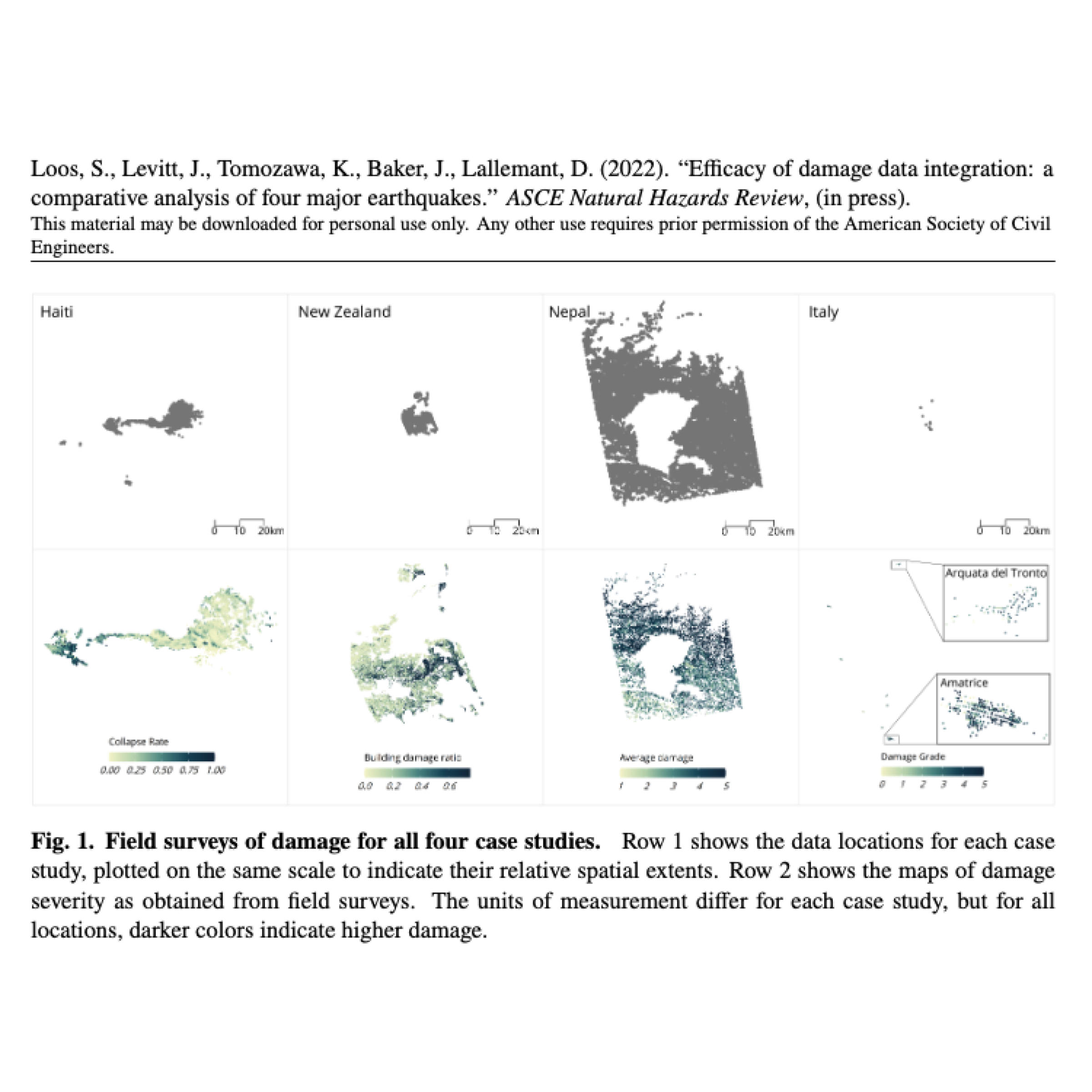
Efficacy of damage data integration: a comparative analysis of four major earthquakes
Sabine Loos
Assistant Professor
In this talk, Sabine presents on three main examples of designing earthquake information to be more actionable by centering user needs and more equitable by prioritizing vulnerable populations.
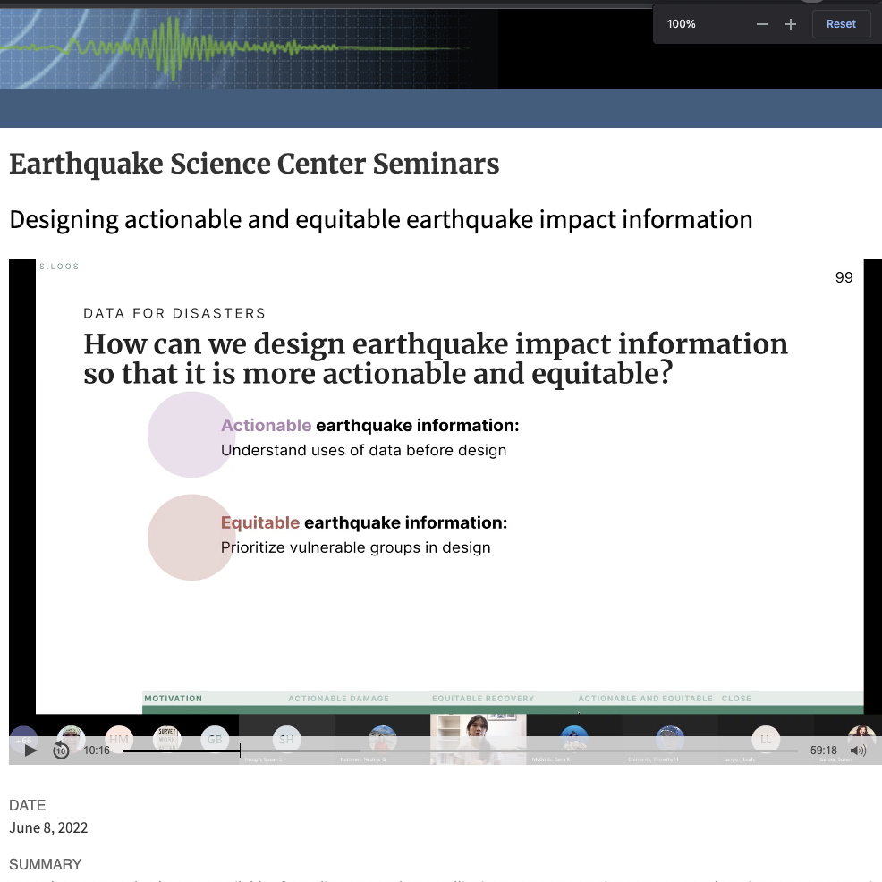
Designing actionable and equitable earthquake impact information
Sabine Loos
Assistant Professor
Code to accompany Efficacy of Damage Data Integration: A Comparative Analysis of Four Major Earthquakes published in Natural Hazards Review
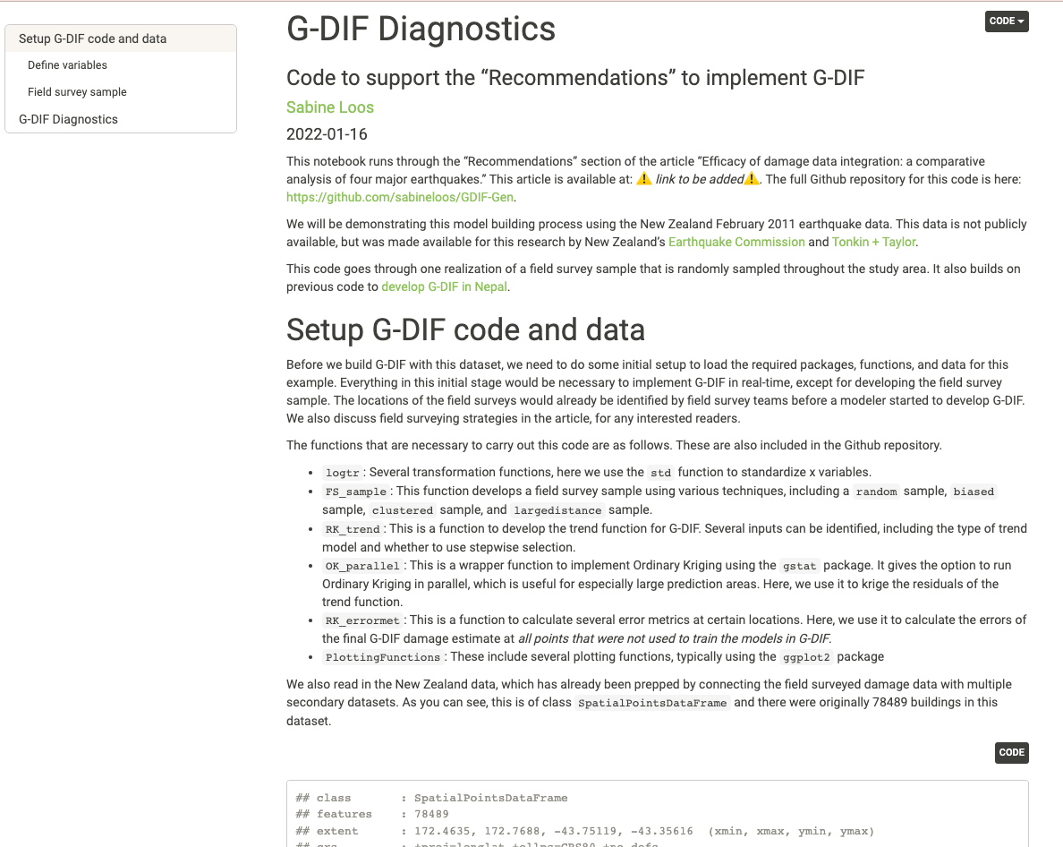
Geostatistical Data Integration Framework Diagnostics Software
Sabine Loos
Assistant Professor
Code to accompany G-DIF: A geospatial data integration framework to rapidly estimate post-earthquake damage published in Earthquake Spectra
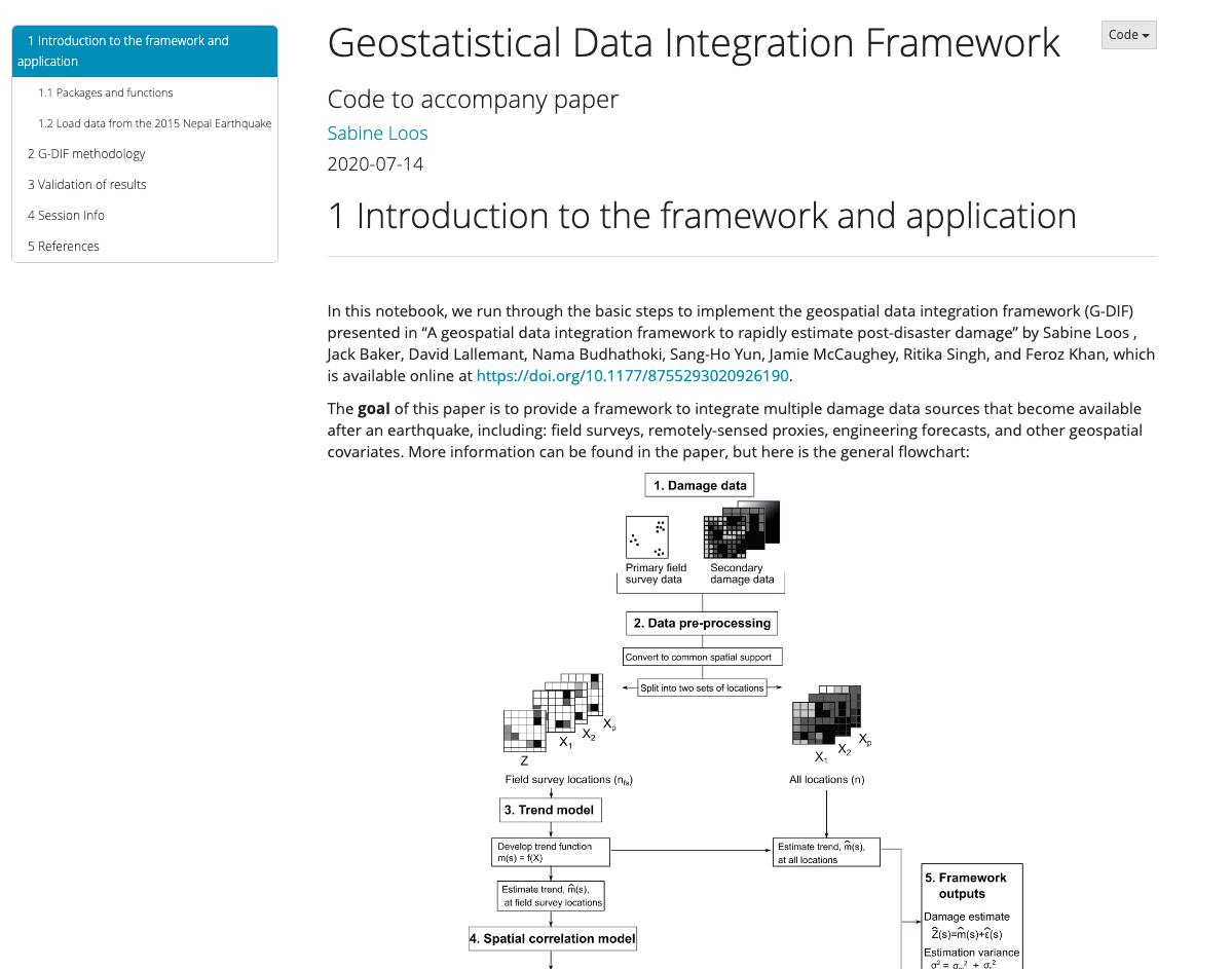
Geostatistical Data Integration Framework Software
Sabine Loos
Assistant Professor
An overview of the project for supporting equitable recovery through impact assessments.
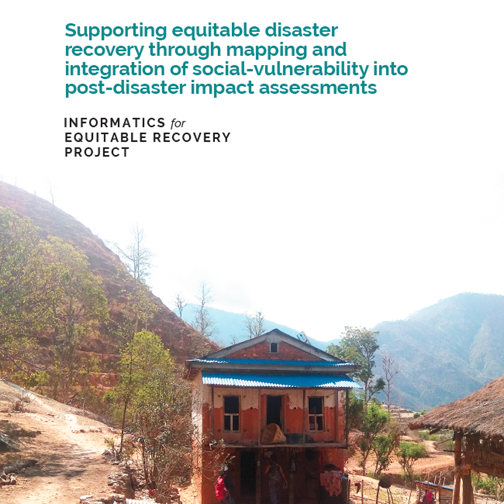
Informatics for equitable recovery: supporting equitable disaster recovery through mapping and integration of social vulnerability into post-disaster impact assessments
Sabine Loos
Assistant Professor
A framework that employs geostatistical methods to combine multiple sources of building damage data into one estimate.
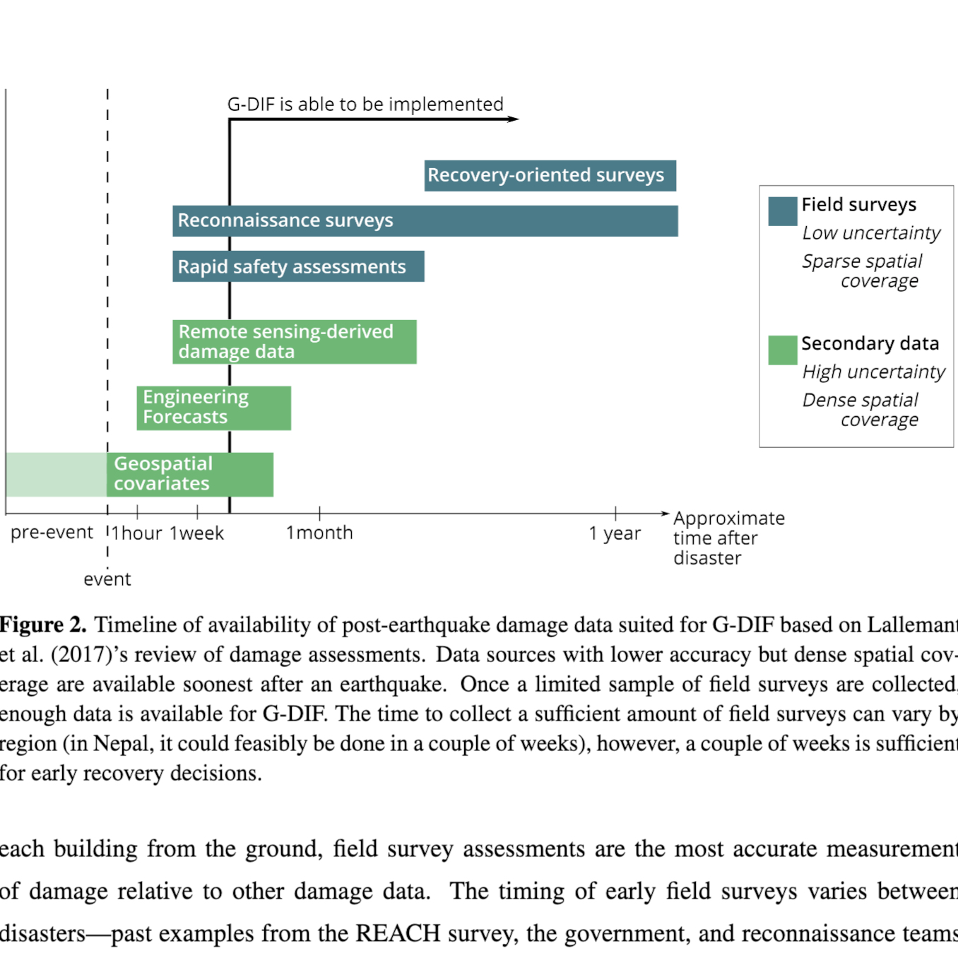
G-DIF: A Geospatial Data Integration Framework to Rapidly Estimate Post-Earthquake Damage
Sabine Loos
Assistant Professor
The Asia-Pacific region is an exciting opportunity for transdisciplinary work, because the research space is still rapidly growing and forming, the region is traditionally less data-rich, which inspires more creative data collection and data use; meanwhile, the hazards are numerous and the risks rapidly evolving due to population growth and climate change, and requires the need to balance development with disaster risk reduction.
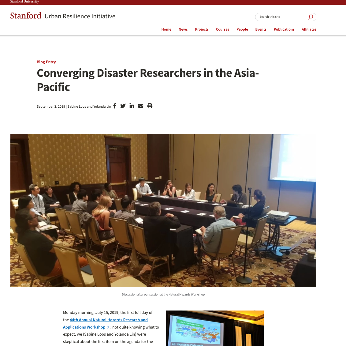
Converging Disaster Researchers in the Asia Pacific
Sabine Loos
Assistant Professor
Exploring the impacts and reconstruction of the 2015 Gorkha earthquake.
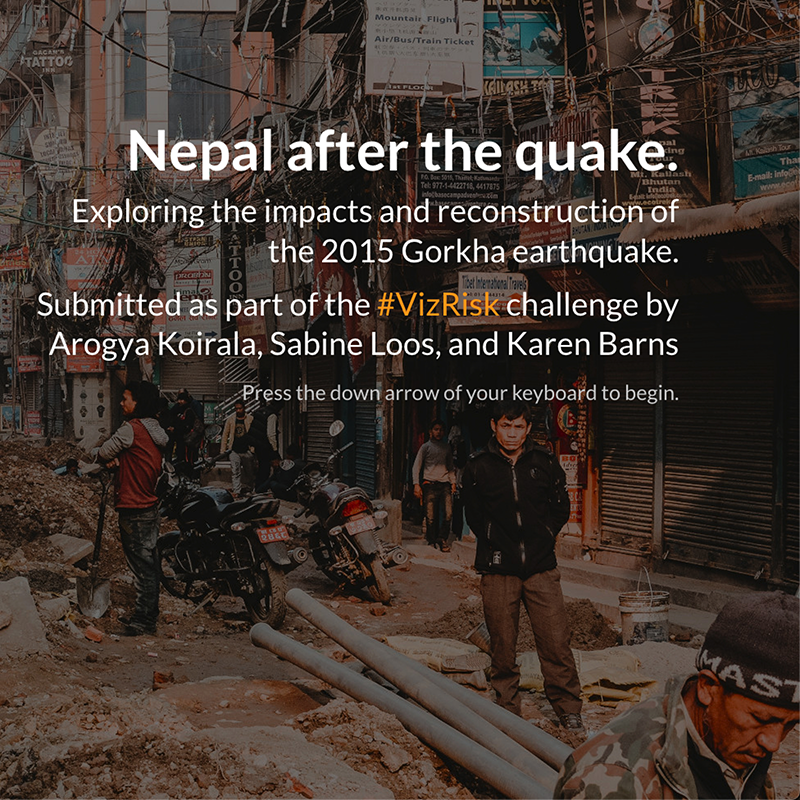
Nepal after the quake.
Sabine Loos
Assistant Professor
Sabine Loos presents on her research on the rapid integration of post-disaster data sources as a basis for impact estimation for recovery planning at our 2nd annual Geospatial Analysis for International Development (Geo4Dev) conference.
Rapid integration of post-disaster data sources - Sabine Loos
Sabine Loos
Assistant Professor
An overview of the development of using remote sensing for crowdsourcec building damage assessment and an evaluation of the uses of this information.
The Development and Uses of Crowdsourced Building Damage Information based on Remote-Sensing
Sabine Loos
Assistant Professor
Why we need metrics other than economic losses for smart recovery decisions.
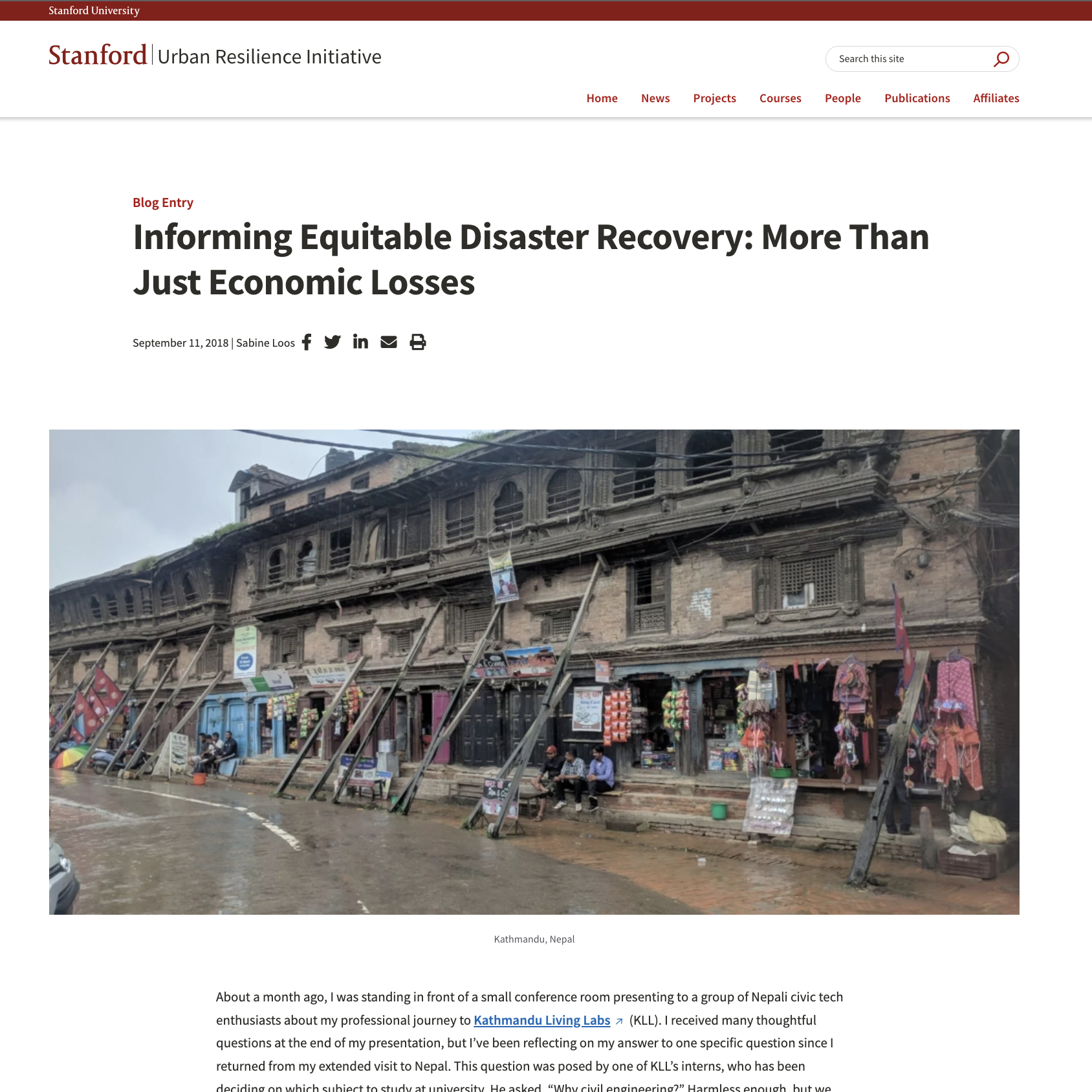
Informing Equitable Disaster Recovery: More Than Just Economic Losses
Sabine Loos
Assistant Professor
Comparing three approaches to crowdsource building damage information using satellite imagery after a disaster.
Crowd-sourced remote assessments of regional-scale post-disaster damage
Sabine Loos
Assistant Professor
Send us an email sloos [at] umich [dot] edu
We are looking for new team members and partners!
Office Address: GG Brown, 2350 Hayward St, Ann Arbor, MI 48109