Projects
As natural hazards are becoming more frequent, insurance companies are withdrawing from high-risk areas in the United States, leaving homeowners without adequate financial protection. While parametric insurance presents a potential solution by offering rapid payouts based on predefined hazard triggers, its adoption by communities and households remains limited due to multiple factors, including potential misalignment between what payouts are provided and community expectations. This study aims to explore the feasibility of reciprocal parametric insurance at the community level, working with households, business owners, and city planners in Sarasota, FL.
Examining Community Needs for Reciprocal Parametric Insurance

Margaret Miles
PhD Researcher
Accessible hazard risk information enables individuals and communities to make critical adaptive or mitigative decisions. However, most disaster risk resources are designed for the average person (e.g., white, middle class, with postsecondary education), leaving marginalized communities—who perceive and respond to hazard information differently—underprepared and vulnerable. This project will develop and implement a community needs assessment and an interactive risk information framework to address the preparedness and risk information needs of marginalized communities. Findings will help governments refine strategies and centralize information through an equity-focused GIS platform, offering tailored emergency preparedness resources to communities and officials. The initiative aims to enhance the adaptive capacity of governments and strengthen resilience at the community level for tens of millions of Americans, with the potential for broader impact at a global scale.

Increasing equity in disaster preparedness and risk communication through a community-centered approach
Margaret Miles
PhD Researcher
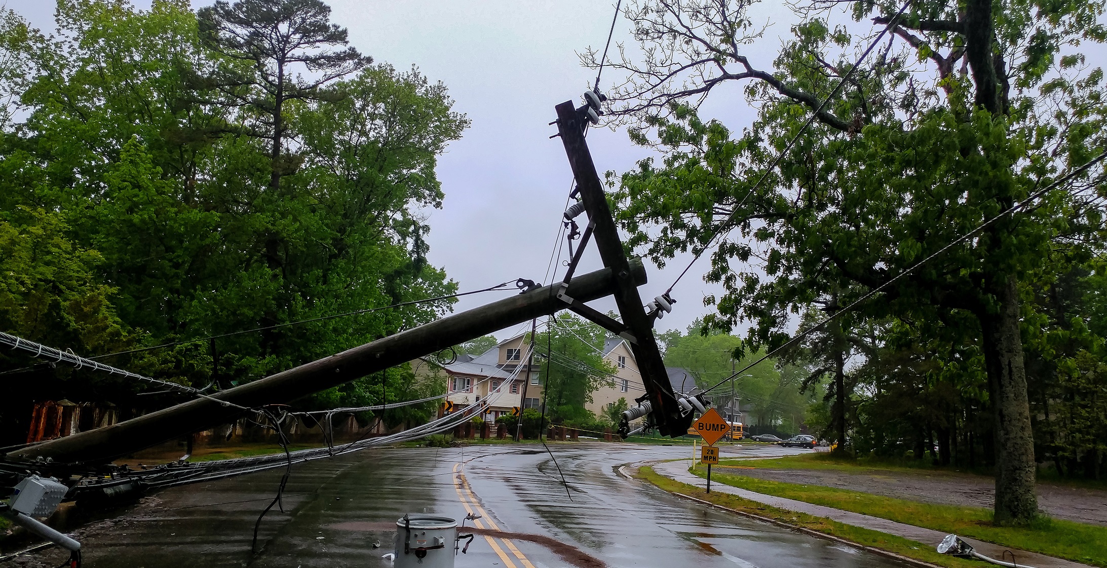
In the immediate aftermath of an earthquake, rapid information about regional impact (e.g., building damage, fatalities, financial loss,etc.) is crticial for both short-term impact assessement and long-term recovery planning. However, traditional methods such as buliding damage surveys do not satsify the urgent data needs that arise in immediate post-earthquake scenarios. This collaborative project seeks to develop a framework that integrates high-resolution commerical satellite data, machine learning, and loss estimation to rapidly generate regional earthquake impact metrics. Findings from the project will promote actionable post-earthquake impact assessment while also supporting long-term recovery planning in the wake of devastating seismic events. The project is supported by the NASA CESRA program.
Rapid assessment of earthquake impacts using commercial satellite data

Sagar Khanal
PhD Researcher
This study aims to address gaps in understanding regarding the effective implementation of AI into emergency dispatch infrastructure by identifying barriers to AI implementation in dispatch systems and addressing potential biases by controlling for the identified obstacles. By leveraging large language models, the study seeks to take the insights gained from regional dispatcher interviews and develop advanced bots capable of responding to non-emergency events with human-like text (e.g., creating prompts that mimic operator responses to gather detailed information from callers), while actively mitigating potential biases present in the model and evaluating its effectiveness via algorithmic fairness testing metrics.

Deploying AI for Emergency Dispatch Services

Christin Salley
Postdoctoral Fellow
Climate change is linked to more intense rainfall leading to more frequent flooding, but we do not understand how populations, especially rural populations, who are repeatedly exposed to such flooding are impacted over the long run. The gap in understanding of the long-term consequences of recurrent flooding on rural populations is partly due to how disasters are quantified and aggregated, where governments often report large disasters that occur in urban areas and cause greater direct losses. This project will approach the challenge of understanding the long-term, cumulative impacts of recurrent flooding associated with climate change on rural populations through a multilevel convergencebased framework that leverages social science-based methods to inform engineering research, and vice versa.
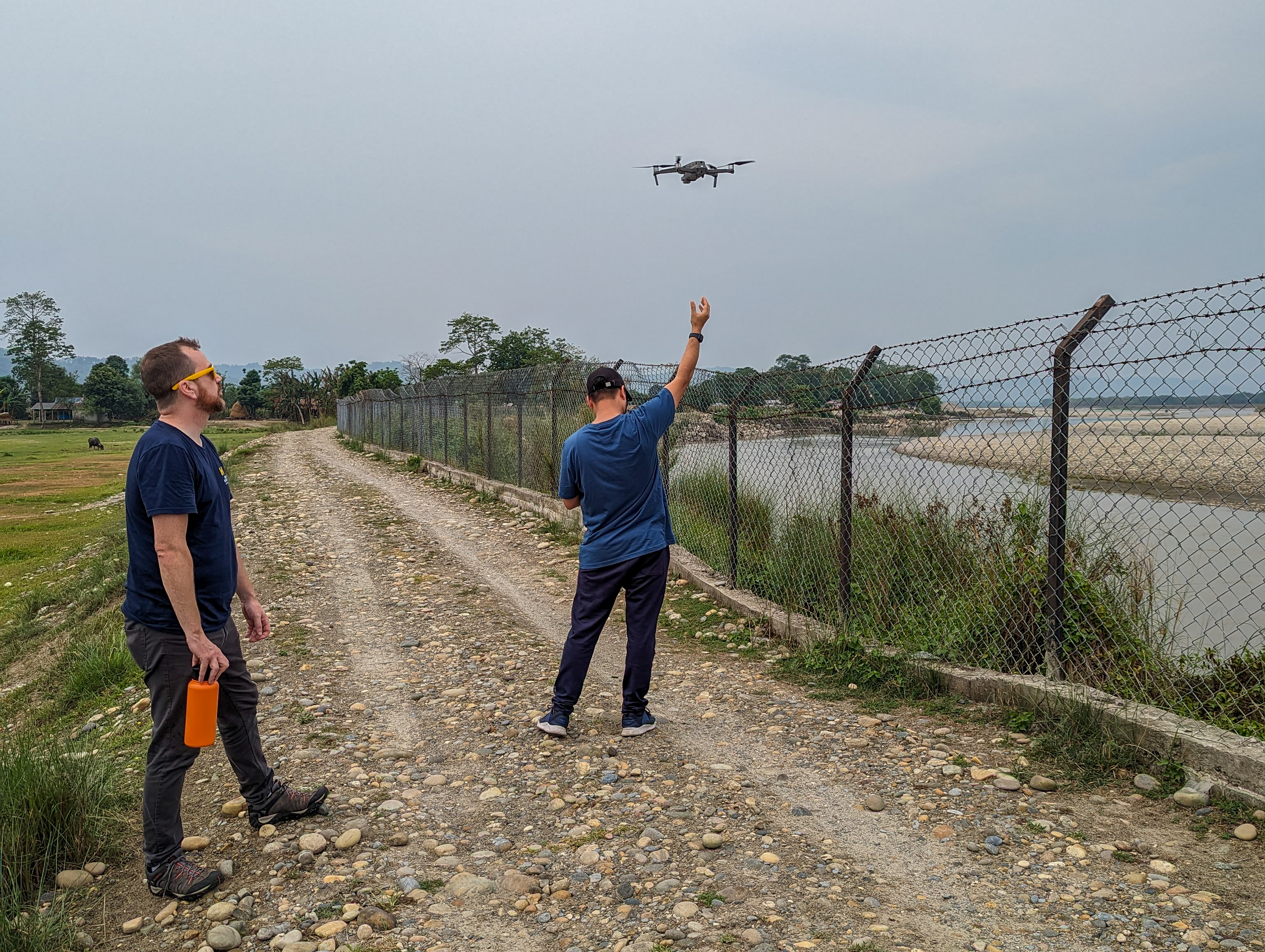
Identifying cumulative consequences of recurrent flooding in Nepal
Brad Bottoms
PhD Researcher
This project supports research focused on understanding population mobility subject to repeated flooding in regions that are historically unprepared to cope with such events. Repeated, low-attention flood disasters do not receive widespread media coverage compared to larger, catastrophic ones. Low-attention flood events are currently understudied, but their cumulative impacts are likely to compound underlying causes of risk, inequality, and poverty. Furthermore, there is not a good understanding of how they contribute to people's decisions to evacuate, return, or permanently move. By filling the knowledge gap, this study aims to better inform local and regional policymakers responsible for designing policies for mitigation strategies and aid distribution before, during, and after these events.
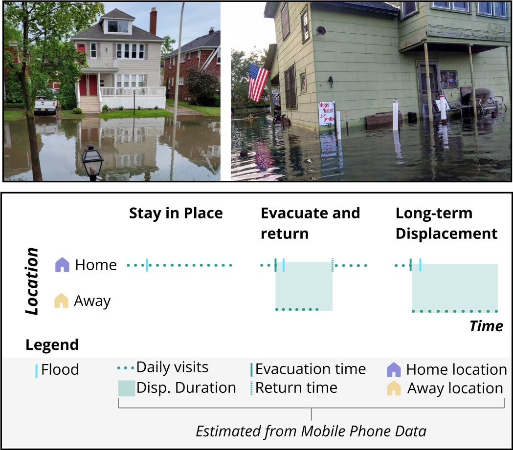
Uncovering the Patterns, Drivers, and Experiences of Population Mobility Due to Low-Attention Flooding

Yue "Major" Zeng
PhD Researcher
The Himalayan Climate Data Field Lab is a month-long, flexible unconference that will gather scholars, practitioners, activists, community leaders, and storytellers to examine the ways that climate change data and information infrastructures shape adaptation and mitigation in the Himalayan region. Join the Field Lab to co-design, test and produce new ideas, analytic tools, maps, sensing technologies, data protocols, artistic pieces and communication products that address climate change and its impacts, with the aim of creating a more equitable and pluralistic data landscape in the Himalayan region.
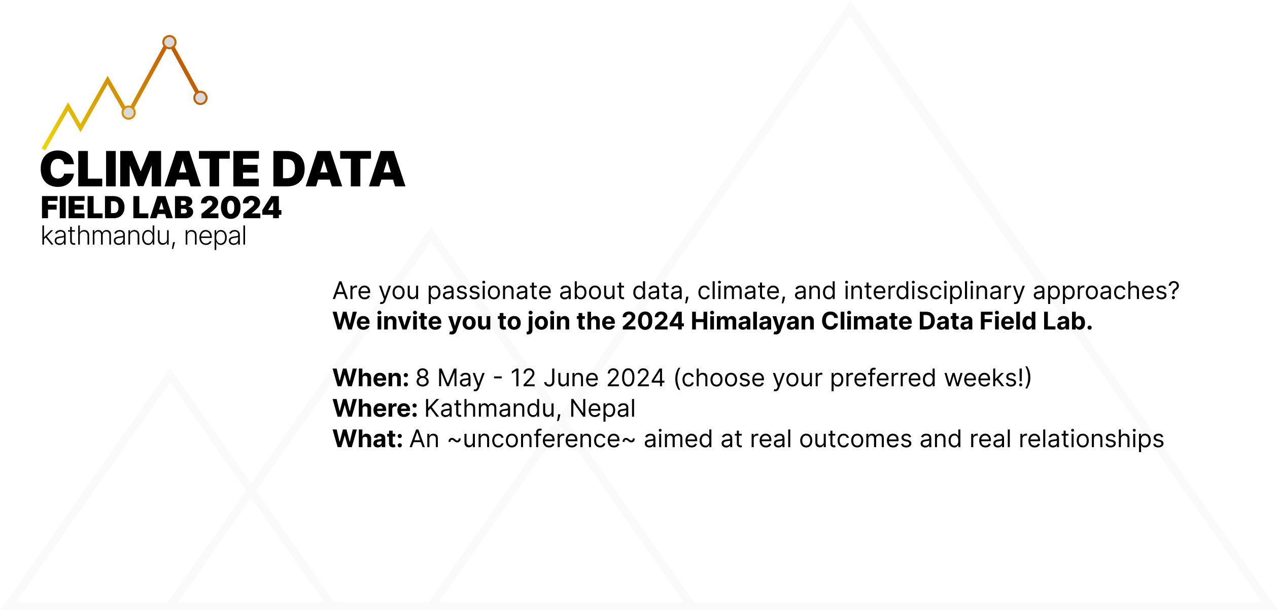
Himalayan Climate Data Field Lab

Apil K C
PhD Researcher
A community-curated, open-access, evolving platform that aggregates global landslide inventories and related geospatial data, providing detailed metadata for each dataset. The platform serves as a central hub for high-quality, globally sourced landslide and geospatial data, supporting the development and benchmarking of reliable, scalable, and generalizable AI models.
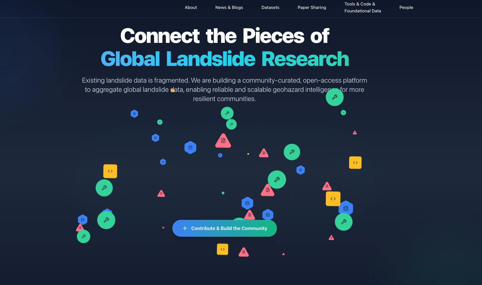
TerraMosaic: A Community-Curated, Open-Access Global Landslide Platform

Xin Wei
Postdoctoral Fellow
While landslides are pervasive across the U.S., their specific social, economic, and ecological impacts remain underappreciated due to their localized and episodic nature, co-occurrence with other hazards, and variability across broad regions. In this study, we leverage generative AI to develop an agentic framework capable of extracting and synthesizing diverse web sources to capture the full range of direct and indirect landslide impacts.
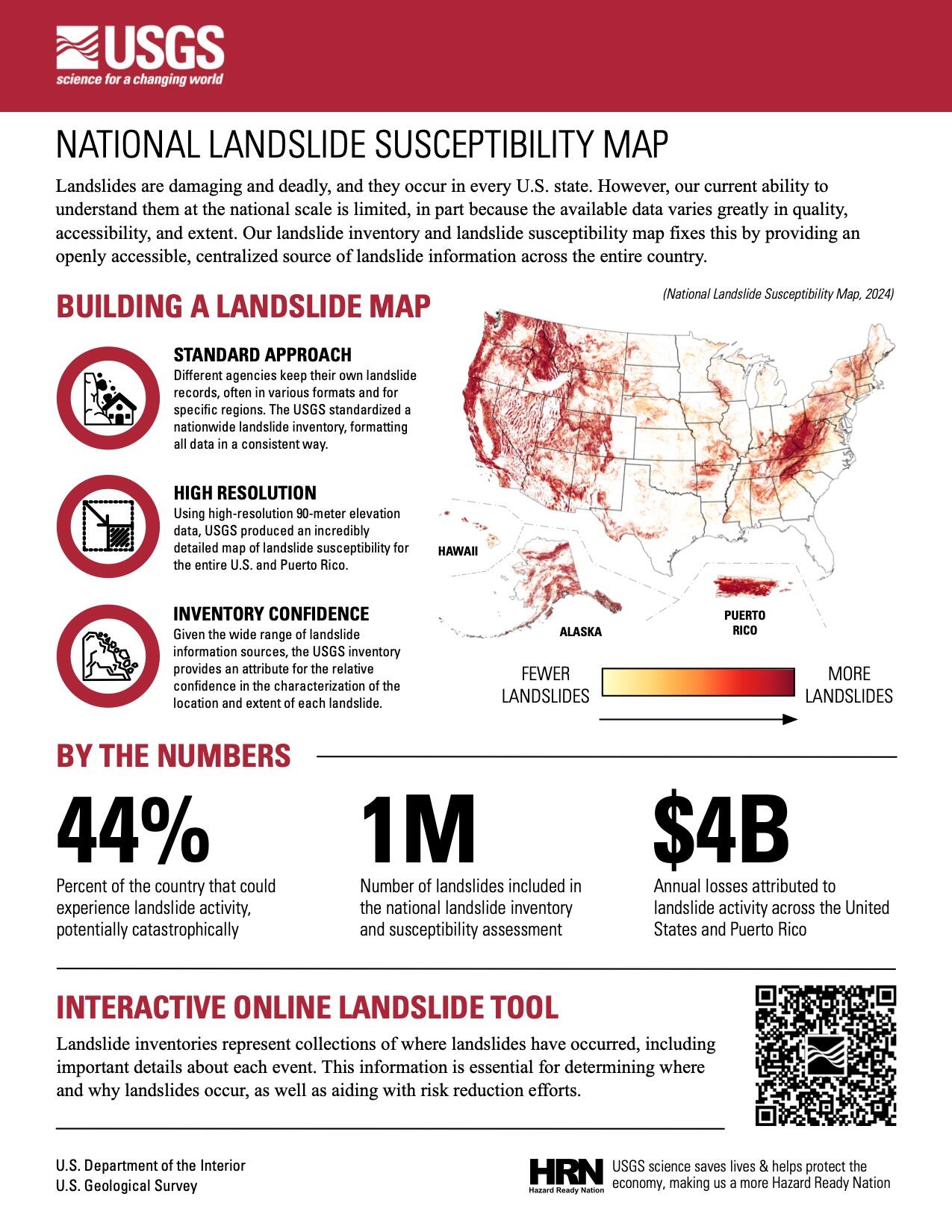
Unveiling the Underappreciated Consequences of Landslides across the United States with Generative AI
Xin Wei
Postdoctoral Fellow
Who responds (and does not respond) to crowdsourced shaking intensity data, Did You Feel It?
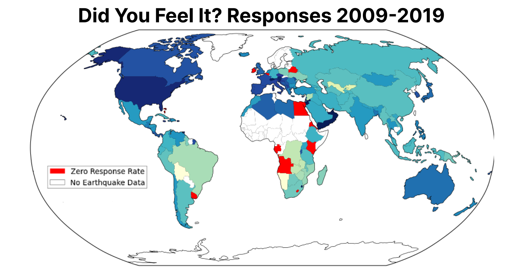
Accessibility of Crowdsourced Shaking Data
Eli Knodel
Researcher
In a collaboration between the USGS and the Natural Hazards Center at CU Boulder, we take a human-centered design approach to co-design the update of USGS earthquake impact products to be more actionable and accessible.
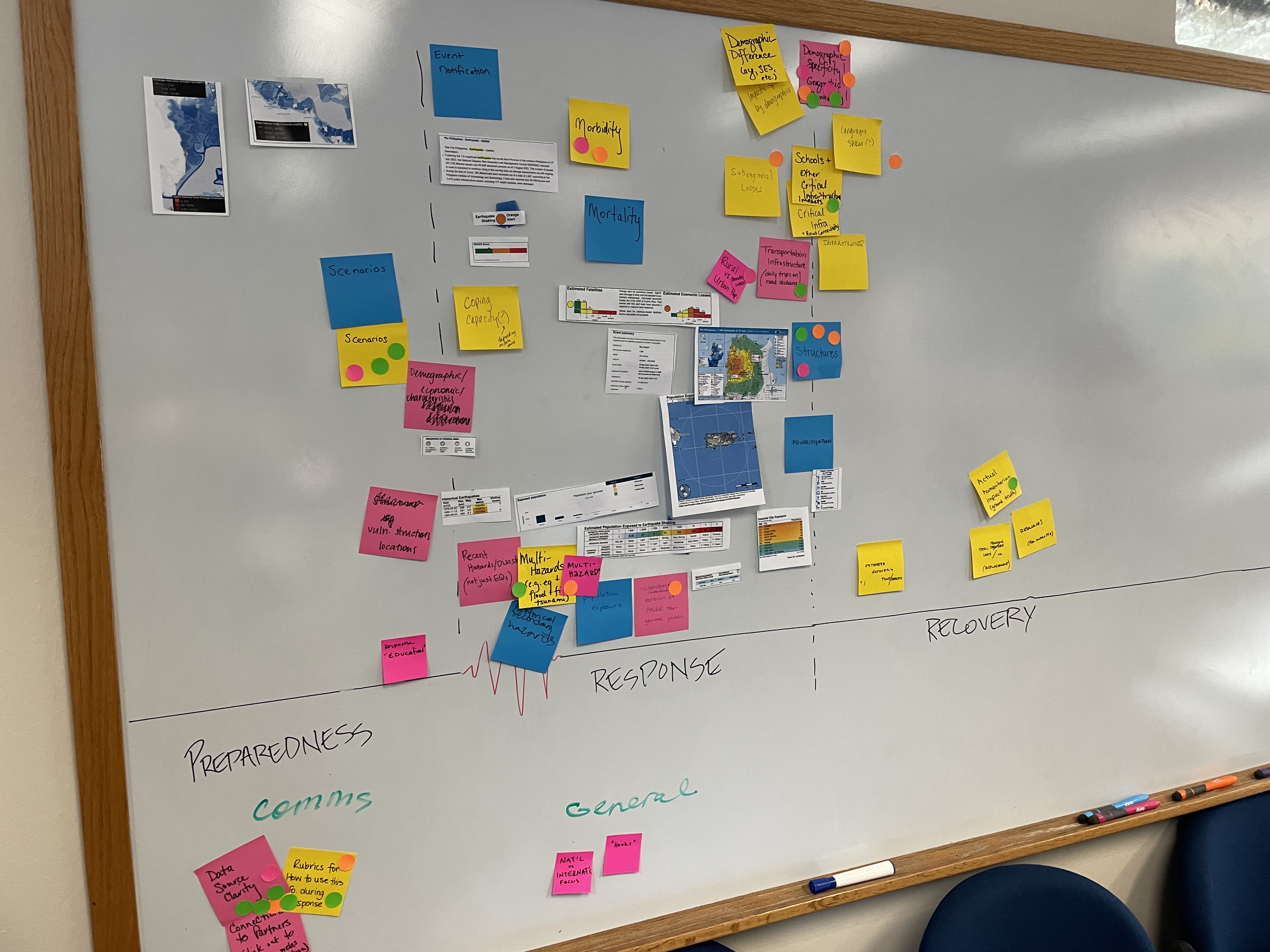
Co-Designing Actionable USGS Earthquake Impact Products to Support Equity-Focused Disaster Management

Sabine Loos
Assistant Professor
From remote sensing to crowdsourcing, an overwhelming amount of building damage data is produced after disasters. While this amount of data signifies impressive technological progress, it does not necessarily mean that all building damage data is usable for post-earthquake decision-making. This research applies geostatistical methods to integrate multiple sources of data to produce rapid estimates of building damage, primarily to support regional decision making.
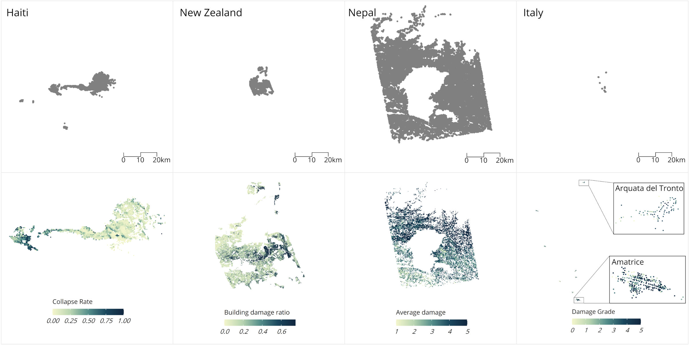
Rapid Building Damage Estimation through Data Integration
Sabine Loos
Assistant Professor
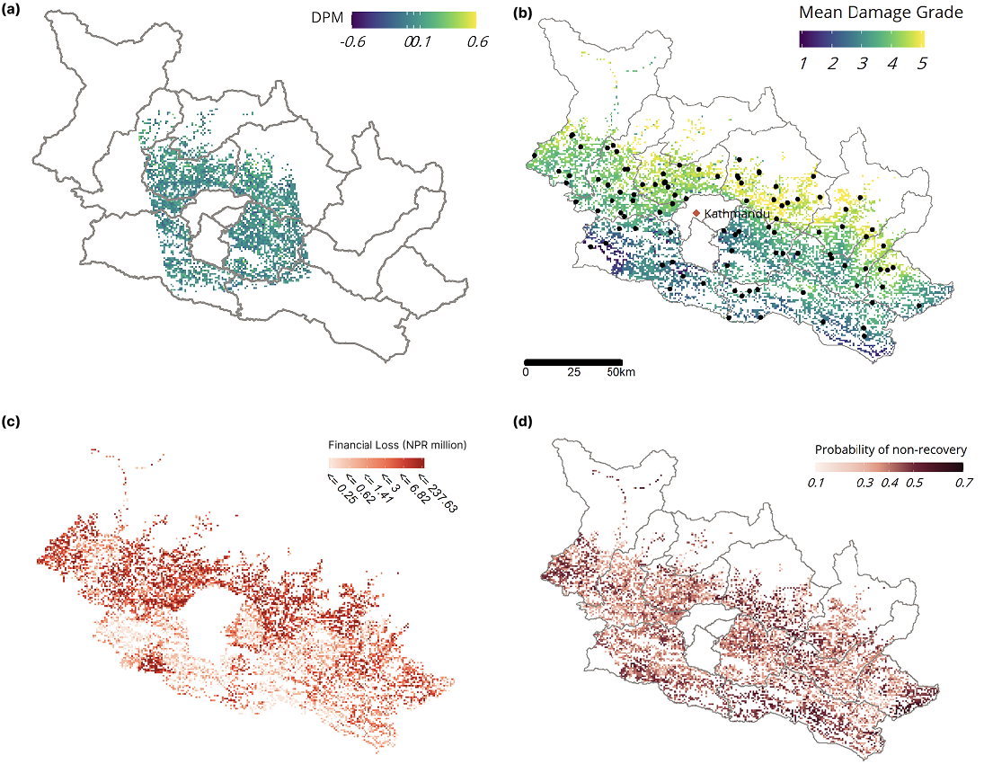
Informatics for Equitable Recovery is a transdisciplinary research collaboration that brings together data scientists, engineers, social scientists, and civic organizations to improve post-disaster information systems and decision support tools.
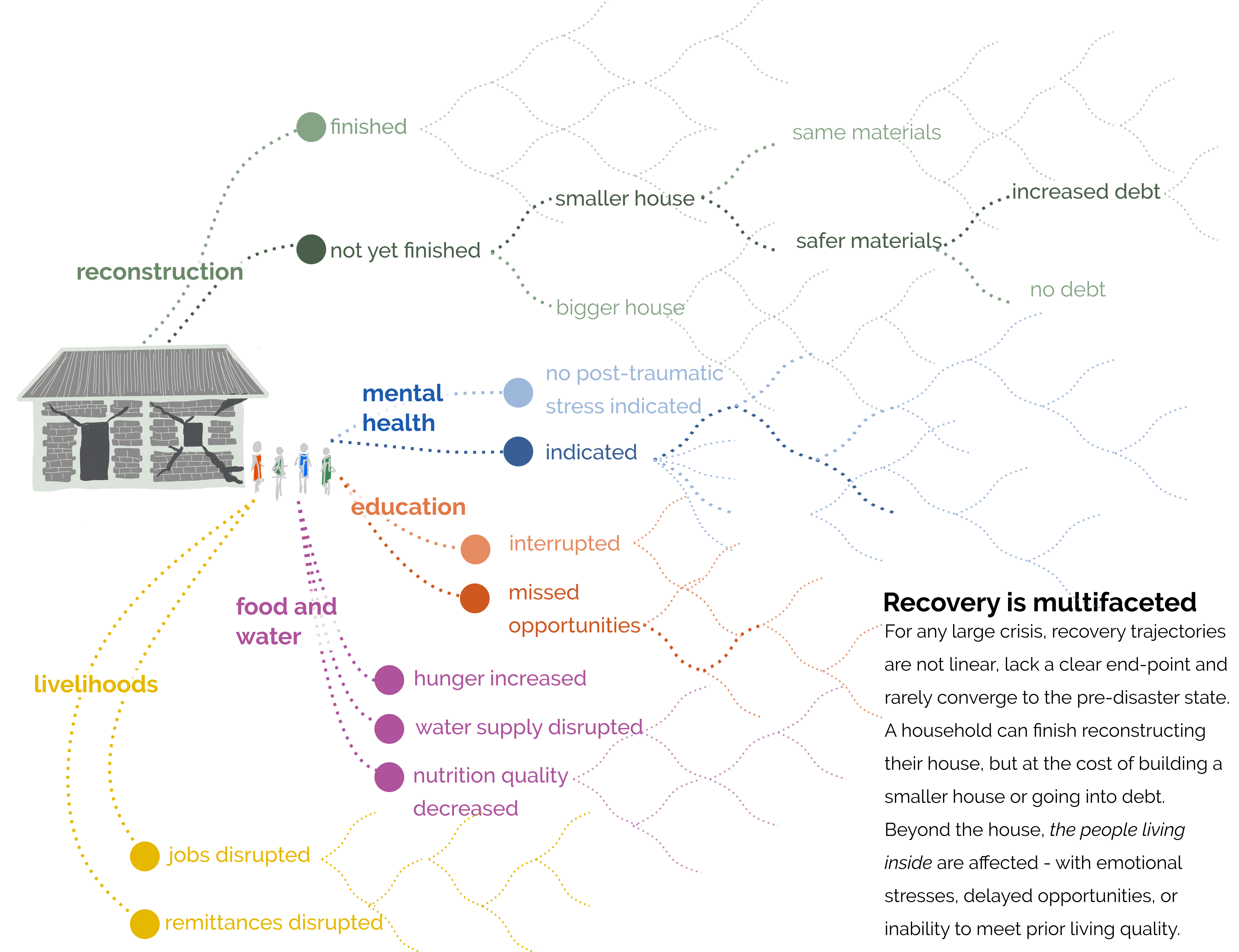
Informatics for Equitable Recovery in Nepal
Sabine Loos
Assistant Professor
As a collaboration between the Stanford Urban Resilience Inititative, Heidelberg University, The World Bank, and Humanitarian OpenStreetMap Team, this project compares three approaches to crowdsourcing building damage data using satellite imagery to inform disaster response decisions.
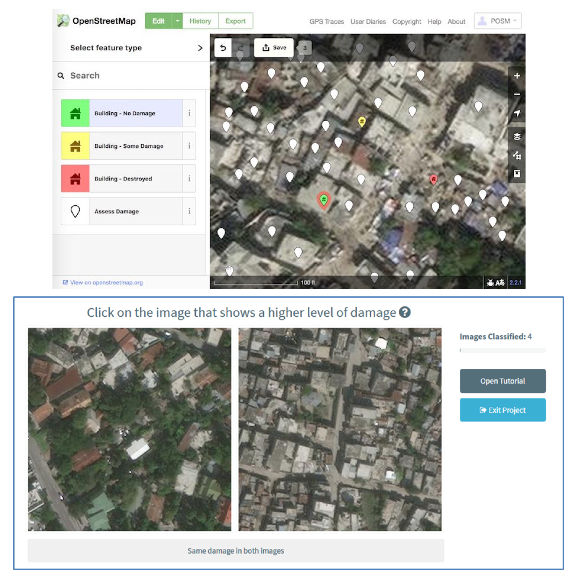
Crowdsourcing Building Damage Data
Sabine Loos
Assistant Professor
Send us an email sloos [at] umich [dot] edu
We are looking for new team members and partners!
Office Address: GG Brown, 2350 Hayward St, Ann Arbor, MI 48109